Who we are
The Company is managed by a team of professionals who are preeminent and dedicated to their professions. Late. Mr M. A.Gafur was Chairman of this Company who spent his lifetime in the profession as Managing Director with Bangladesh Survey Organization (BSO) is probably the most regarded person in Survey and Mapping arena in Bangladesh.
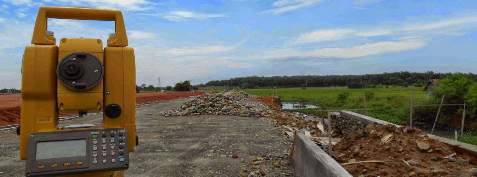
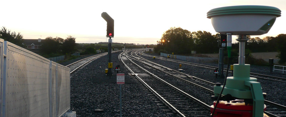
The firm is fully equipped with modern survey hard and software manned by highly skilled and experienced staff. 3D Consultants is fully capable in establishing precise control points using GNSS (Global Navigation Satellite Systems) receivers in Static mode to create establishment of Control points. Static and Kinematic GPS survey techniques: High precision techniques based on post processing of carrier phase measurements. Real – Time Kinematic (RTK): versatile high precision techniques that use carrier phase measurements in an instantaneous positioning mode and collecting topographical data using Total Stations, generating most accurate digital terrain models and digital data on any desired format ready for use in computer aided design or mapping software, resulting in time and quality efficient project execution.
The CAD & GIS Division is equipped with latest hard and software with Plotters, Map Scanners, Map Printers and Laser Printers and supported by GIS and CAD software.
3D Consultants is committed to the profession, quality and high standard of professionalism.
Please call us should you need our assistance and services in your present and upcoming projects.
Services we offer
Survey & Mapping
- Topographical survey
- Hydrographical survey (river training, bridge sites)
- Geodetic survey
- Establishment of control point (RTK GPS)
- Geo- referencing (RTK GPS)
- Alignment survey
- Route survey (road, railway, power, gas water, rope way)
- Physical future survey for master planning
- Urban development survey and mapping
- Irrigation survey and mapping
- Land classification survey
- Water supply and sewerage system mapping
- Land use
- Geometric design and pavement design
- Drafting, fair mapping and reproduction
- Soil investigation
GIS and Database Management
Geographic Information System (GIS) has grown dramatically in the 1980s from obscurity to become more common in business, universities and government organizations where they are now used for many diverse applications.
GIS is used by different government organizations and individuals to access and manage fantastically varied sets of geographically related information’s+, although it can create maps at different scales in different projections and data attribution. Such as:
- An engineering department monitors the condition of roads, Bridges and creates planning maps for urban areas.
- A tax assessor’s office produces land use maps for appraises and Planners.
- A transit department produces maps of bicycle paths for commuters.
- A water department finds the values to isolate a rupture water main.
- To create a terrain map to find locations for new cell phone antenna.
WORK UNDER GUIDANCE OF Mr. Md.Omar faruk (3D CONSULTANT)
| SL.NO | Name of Project | Client | Year | Area/Length | Type of Job |
|---|---|---|---|---|---|
| 1 | Topographical survey of Feeder Roads & National Roads under Third Road Rehabilitation Project (RRMP-III), | Bangladesh Consultants Ltd.(BCL) | 2000-2001 | 158 Km | Detail Topographicalsurvey |
| 2 | Canadian High Commission | High Commission | 2003-2004 | 4.5 acre | Detail Topographical survey & Section |
| 3 | Topographical survey of Rural Transport Improvement Project (RTIP) | SMEC/Development Design Consultants Ltd. (DDC) | 2004 | 182 Km | Detail Topographical survey |
| 4 | Detail Topographical Survey & Data Processing of RIIP-25 | Bangladesh Consultants. (BCL) | 2004 | 183 Km | Detail Topographical survey |
| 5 | Feasibility Study on Construction of the Padma Bridge. Mawa to Charjanat & Paturia to Goualanda | Bangladesh Engineering & Technological Services Ltd. (BETS) | 2003 | 37 Km | Topographical Survey & Bathymetric Survey |
| 6 | Rupsha Bridge Project Bathymetric Survey | SHIMIZU –ITD JOINT VENTURE | 2003 | 18 Km | Topographical Survey & Bathymetric Survey |
| 7 | Lafarge Surma Cement Conveyor route | Lersen & Tobroo (L&T) India | 2003 | 10.00 km | Topographical Survey & Cross section |
| 8 | Dapdapia Bridge Project on Kirtonkhila river | Development Design Consultants Ltd. | 2003 | 4 km. | Hydrographic Survey, Cross Section and Profile Survey. |
| 9 | Lafarge Surma Cement Main Plant site | Lersen & Tobroo (L&T) India | 2002 | 70.00 Hector. | Hydro graphic Survey, Cross Section and Profile. |
| 10 | Lafarge Surma Cement jetty Project on Surma river | Lersen & Tobroo (L&T) India | 2002-03 | 99 km. | Cross Section and Profile. |
| 11 | Detail Topographical Survey of Canadian High Commission at Baridhara. | Canadian High Commission | 2003 | 3 Acre | Detail Topographical Survey |
| 12 | Topographical Survey of Detailed Area Plan (DAP) for Metropolitan Development Planning area, Group-A, | RAJUK | 2004/2005 | 105000 Acre | Detail Topographical Survey, Physical feature Survey, infrastructure Survey, |
| 13 | Topographical Survey of Detailed Area Plan (DAP) for Chittagong Metropolitan Master Plan (CMMP) CDA. | CDA | 2005/2006 | 70000 Acre | Detail Topographical Survey, Physical feature Survey, infrastructure Survey, |
| 14 | Detail Topographical Survey of Proposed Flyovers at Koril . | DDC | 2007 | 150 Acre | Detail Topographical Survey, Cross Section Survey. |
| 15 | Detail Topographical Survey of Proposed Flyovers Mogbazar Malibag Intersection. | BCL | 2005 | 4.6 Km | Detail Topographical Survey, Cross Section Survey. |
| 16 | Detail survey and setout of Interchange No: 8 on Sheikh Zayed Road Project at U.A.E | Shimizu Corporation | 2007-2010 | 10 Km | Topographical Survey |
| 17 | Detailed Area Plan (DAP) at Nilphamary, Thakurgaon, Dinajpur and Rangpur District. | LGED | 2009-2010 | 35000 acres | GPS based advanced Topographic, Physical Feature, Infrastructure and Land use survey |
| 18 | Tangail-Hatikamrul road section in N4 and N405 | SMEC-RHD | 2012-2013 | 37 Km | Detail Topographical Survey, Cross Section Survey. |
| 19 | Upgrading of Rangpur-Teesta-Burimari Road into 4-lane highway. | SMEC-RHD | 2012-2013 | 138 Km | Detail Topographical Survey, Cross Section Survey. |
| 20 | Upgrading of Sonamasjid-Rajshahi-Hatikamrul Road into 4 lane highway (Asian Highway, SAARC Corridor: Regional Corridors identified in SAARC Regional Multimodal Transport Study) | SMEC-RHD | 2012-2013 | 116 Km | Detail Topographical Survey, Cross Section Survey. |
| 21 | Upgrading of Khulna-Mongla Road into 4-lane highway with link to Dhigraj to Mongla Ferry Ghat. | SMEC-RHD | 2012-2013 | 37 Km and 70 Hector | Detail Topographical Survey and Hydrological Survey Cross Section Survey. |
| 22 | Comilla – B. Baria (N102) and Darkhar – Akhura (Z1201) Road | HIFAB-RHD | 2012-2013 | 120 Km | Detail Topographical Survey, Cross Section Survey. |
| 23 | Daulatdia- khulna road from Kamarkhali bridge. | HIFAB-RHD | 2012-2013 | 40 Km | Detail Topographical Survey, Cross Section Survey. |
| 24 | GCP Survey for Regional Development Planning (RDP) Project of RAJUK. | SAMAN Corporation | 2014 | 1600 Sq.Km | 1600 Sq.Km |
| 25 | Topographical Survey of UZRs, UNRs, GCMs and Ghats for RTIP-II | LGED-DDC | 2013-14 | 105 Km. | Detail Topographical Survey, Cross Section Survey. |
| 26 | Detail Topographical Survey for Dhaka-Chittagong Expressway PPP Project, Daudkandi to Feni (Package-2). | SMEC-RHD | 2014-15 | 110 Km | Detail Topographical Survey and Hydrological Survey Cross Section Survey. |
| 27 | Detail Topographical Survey for Dhaka-Chittagong Expressway PPP Project, Feni to port connection (Package-3). | SMEC-RHD | 2014-15 | 90 Km | Detail Topographical Survey and Hydrological Survey Cross Section Survey. |
| 28 | Detail Topographical Survey for Dhaka-Chittagong Expressway PPP Design Project (Package-1). | SMEC-RHD | 2015-16 | 90 Km | Detail Topographical Survey and Hydrological Survey Cross Section Survey. |